Showing posts with label Drone. Show all posts

Friday, June 9, 2023

How Using Drones Is Changing The Roofing Industry

Drones are revolutionizing the roofing industry by providing numerous benefits and improving various aspects of the roofing process. Here are some ways in which drones are enhancing the roofing industry:

  1. Roof Inspections: Drones equipped with high-resolution cameras can quickly and accurately inspect roofs, capturing detailed images and videos. This enables roofing professionals to identify issues such as cracks, leaks, or damaged shingles without physically climbing onto the roof. It saves time, reduces risks, and allows for more thorough inspections.

  2. Safety: Roof inspections and maintenance tasks often involve risks for workers, such as falls from heights or exposure to hazardous materials. By using drones, roofing professionals can significantly reduce these risks as they can perform inspections remotely. Workers can operate the drones from the ground, eliminating the need to climb ladders or walk on potentially unsafe roofs.

  3. Efficiency and Time-Saving: Drones enable faster roof inspections compared to traditional methods. Instead of manually inspecting each area, a drone can fly over the roof and capture comprehensive images and videos within a short time. This efficiency leads to time savings, allowing roofing professionals to assess more roofs in a day.

  4. Accuracy and Documentation: Drones capture high-resolution images and videos that provide precise details of the roof condition. These visuals can be stored and analyzed later, ensuring accurate documentation of roof inspections. The detailed data collected by drones helps roofing professionals to create more precise estimates, identify specific problem areas, and make informed decisions.

  5. Accessibility: Some roofs are challenging to access due to their height, steepness, or structural complexities. Drones can access these hard-to-reach areas easily and capture visual data. This accessibility allows roofing professionals to assess the condition of roofs that were previously difficult or dangerous to inspect.

  6. Thermal Imaging: Advanced drones equipped with thermal cameras can identify areas of heat loss or water intrusion in roofs. Thermal imaging technology can detect temperature differences and highlight potential leaks or insulation issues. This capability enables early detection of problems that may not be visible to the naked eye, helping to prevent further damage and increase energy efficiency.

  7. Marketing and Presentations: Drones can capture impressive aerial footage and images of completed roofing projects. Roofing companies can utilize this visual content for marketing purposes, showcasing their work and expertise to potential clients. Aerial views provide a unique perspective and enhance presentations and proposals, giving customers a better understanding of the scope and quality of the roofing project.

safetywithdrones

Friday, December 3, 2021

Aerial Photography - A Great Point of view

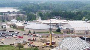
Aerial Photography: I have been interested in photography for as long as I can remember. And have actually experimented with various forms. These are amongst my most fascinating accomplishments in the field of photography. And I have actually discovered that Aerial Photography can provide some assistance to your personal creativity.

DJI_0013.480-300x169.jpg

History

This brand-new innovation was first utilized extensively during World War I. Wherein 1918 systems in France took as many as 10,000 pictures per night throughout peak activity. The second world war aerial pictures were utilized thoroughly for military operations to spy on the opponent. And evaluate their setups and ground battling capabilities.

These photographs provided updated and reasonable impressions of the topography. Along with troop movement on the ground and potential targets. Once an attack against the enemy was total aerial reconnaissance photographs were utilized to evaluate the damage and to form an opinion as to the success of the objective.

In 1957, aerial photography reached brand-new heights with the Russian's first satellite launch of the Sputnik. This was the start of satellite images. Then in 1972, with the first launch of Landsat satellites by NASA satellite imagery was sold commercially for the first time.

Today's Utilizes

There are lots of prospective industrial and non-commercial usages for photos drawn from above. Today they are utilized for establishing topographic maps, planning land usage, archeology, production of movies, espionage, ecological and weather studies, commercial color advertising for publications, billboards, posters and postcards, hobbies, and lots of other fields.

Making use of innovation has also crawled into this field of photography. Advances in radio control innovation have actually enabled using aircraft models. Which are controlled from the ground to carry out low-altitude photography? This solution is mainly used for marketing. And in the realty industry to attend to safety guidelines that forbid manned airplane from flying at low altitudes over inhabited locations. This radio-controlled airplane works well in this environment. And offers a low-priced option to the professional photographer.

Public Domain

Aerial pictures are thought about public domain since the pictures are drawn from bird's-eye views which are thought-about public locations. As a result, you will find that there are numerous methods to view aerial photos on-line. One of the most popular today can be discovered at Google Earth. Which supplies satellite imagery along with aerial photos of the planet.

You can in fact use the service to search for locations in a provided area. Such as parks, restaurants, schools, and hotels. It can likewise be used to recognize the best routes for reaching a given location. You can also view the aerial photographs from various angles by tilting and turning them on screen.

If you are interested in discovering more about this topic you can browse through some raw materials at your library or use the internet. Which offers a wealth of info on the history, advantages, and industrial service providers. In addition, if you are simply beginning or wish to broaden your hobbies as a professional photographer just stops by your regional neighborhood airport.

There you will find a number of flight schools and other flight services where for a reasonably little investment you can delight in a one hour flight and include lots of intriguing images to your portfolio.

Wednesday, December 1, 2021

Aerial Photography - A Great Point of view

Aerial Photography: I have been interested in photography for as long as I can remember. And have actually experimented with various forms. These are amongst my most fascinating accomplishments in the field of photography. And I have actually discovered that aerial photography can provide some assistance to your personal creativity.

DJI_0013.480-300x169.jpg

History

This brand-new innovation was first utilized extensively during World War I. Wherein 1918 systems in France took as many as 10,000 pictures per night throughout peak activity. The second world war aerial pictures were utilized thoroughly for military operations to spy on the opponent. And evaluate their setups and ground battling capabilities.

These photographs provided updated and reasonable impressions of the topography. Along with troop movement on the ground and potential targets. Once an attack against the enemy was total aerial reconnaissance photographs were utilized to evaluate the damage and to form an opinion as to the success of the objective.

In 1957, Aerial Photography reached brand-new heights with the Russian's first satellite launch of the Sputnik. This was the start of satellite images. Then in 1972, with the first launch of Landsat satellites by NASA satellite imagery was sold commercially for the first time.

Today's Utilizes

There are lots of prospective industrial and non-commercial usages for photos drawn from above. Today they are utilized for establishing topographic maps, planning land usage, archeology, production of movies, espionage, ecological and weather studies, commercial color advertising for publications, billboards, posters and postcards, hobbies, and lots of other fields.

Making use of innovation has also crawled into this field of photography. Advances in radio control innovation have actually enabled using aircraft models. Which are controlled from the ground to carry out low-altitude photography? This solution is mainly used for marketing. And in the realty industry to attend to safety guidelines that forbid manned airplane from flying at low altitudes over inhabited locations. This radio-controlled airplane works well in this environment. And offers a low-priced option to the professional photographer.

Public Domain

Aerial pictures are thought about public domain since the pictures are drawn from bird's-eye views which are thought-about public locations. As a result, you will find that there are numerous methods to view aerial photos on-line. One of the most popular today can be discovered at Google Earth. Which supplies satellite imagery along with aerial photos of the planet.

You can in fact use the service to search for locations in a provided area. Such as parks, restaurants, schools, and hotels. It can likewise be used to recognize the best routes for reaching a given location. You can also view the aerial photographs from various angles by tilting and turning them on screen.

If you are interested in discovering more about this topic you can browse through some raw materials at your library or use the internet. Which offers a wealth of info on the history, advantages, and industrial service providers. In addition, if you are simply beginning or wish to broaden your hobbies as a professional photographer just stops by your regional neighborhood airport.

There you will find a number of flight schools and other flight services where for a reasonably little investment you can delight in a one hour flight and include lots of intriguing images to your portfolio.